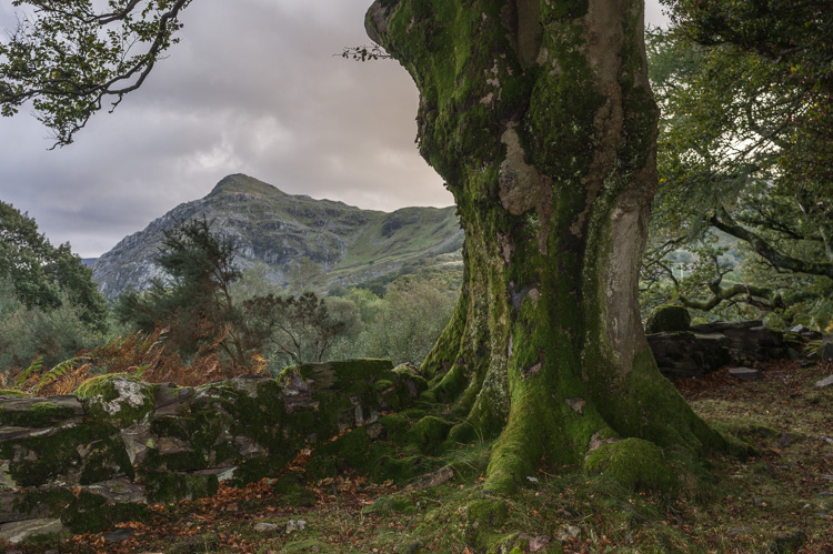
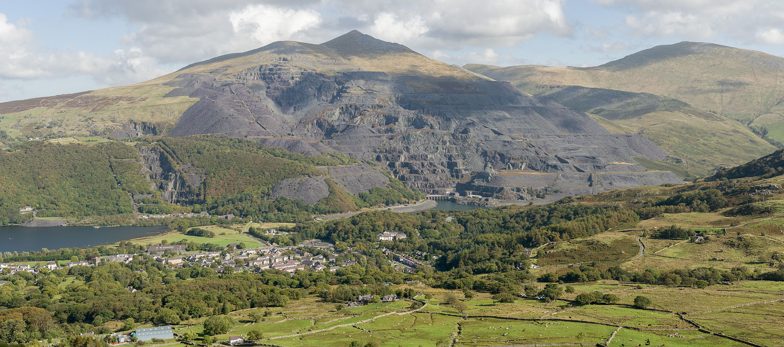
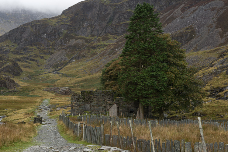
Snowdonia (Wales)


Tree

An old tree above Llyn Peris together with the evening light delivers one of those views known from fantasy movies.

Castle

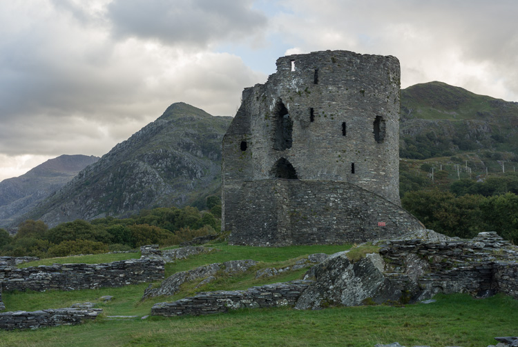
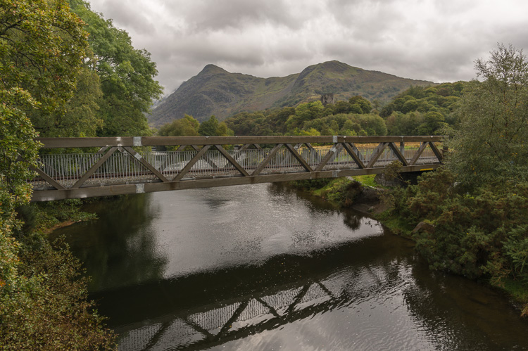
Today only a ruin, Dolbadarn Castle dates back to the 13th century and sits near Llanberis, overlooking both Llyn Padarn and Llyn Peris.
Tree Dolbadarn Castle


Lake

Just below a nasty cloud layer and near the junction of Miner's and Pyg Tracks, we look down at Lake Glaslyn

Waterfall

The Afon Glaslyn, discharging from the lake, rushes down over rocks towards Llyn Llydaw.
Glaslyn Waterfall Afon Glaslyn


Quarry

Llanberis on Llyn (Lake) Padarn also hosts a big slate quarry, which has digested a good part of Elidir Fawr (924 m). Today the mine is closed, leaving behind the National Slate Museum and containing an almost invisible huge power station, the Dinorwig Power Station built in 1984.

View of Llanberis

Llanberis

Colorful houses line the main street, houses in which generations of miners have lived. Today, the town's economy feeds on tourism.

Caernafon

Down at the coast, in the city of Caernafon, the large castle is worth a visit. Built by King Edward I back in the 13th century, it is in good condition. Good physical condition is required if one wants to walk up and down of all the towers of the castle.
Llanberis Caernafon Castle


Sun

The weather chased us during our stay and the sunny moments were rare. Here the evening sun falls on Elidir Fawr and the slate quarry.

Bridge

The Lake Railway crosses the short stretch of river between Llyn Peris and Llyn Padarn, a steam-driven train left over by the slate quarry.
Slate Mine Bridge over Afon Nant Peris


Path

The lone but healthy trees standing beside Watkin Path must have somehow escaped the British Fleet and the mining business.

Ruin

Many ruined houses are scattered within the mountains, either remnants from old disused mines or farmhouses.
Watkin Path Ruines


Mountain

The area is called Snowdonia after its highest mountain, Mt. Snowden (1085 m). There are other peaks in the surroundings that are almost as high, but this one is the highest. Well, one has to mention the railway leading to the top, hence the popularity. Seen from the northwest, with the Ranger Path on the left side, one of the six approaches to the summit.

Snowden


Summit

Three times we climbed up on Snowden in all, and haven't seen anything at all. This is the very summit, a small heap of a little mountain in itself. A bit further down is the railway station with direct access to a restaurant.

Railway

It's the comfortable way up Snowden along the Llanberis Path. But: In bad weather it might be closed, and along with the restaurant. And for those speculating for an easy way down after an exhausting ascent, only a limited number of seats is available on the train.
Snowden summit Railway


Miner's huts

The Snowden seen over ruined huts standing on the territory of the Dinorwig Slate Quarries. The ridge to the summit is the way for both the railway and the Llanberis Path.

Quarry

An official trail leads trough the Dinorwig Slate Quarries which were closed in 1969. Combined with a visit to the National Slate Museum it may take a whole day.
Ruines in slate mine Trail in slate mine


Animals

The whole of the country is governed by sheep. As for a wild species, one has to seek satisfaction in a seagull, this one on Pen-y-Pass. I've shot another one up on Snowden, gready for crumbs left over by tourists.

Sheep

As said, they are everywhere. These, in a fenced-up sheepfold on the outskirts of Llanberis, are special. I've never seen such a king-sized monster like this buck.
Seagull Sheep


Landscape

A view to the west during our descent down Miners Track after having scrambled up Watkin Path into the windy clouds and in rain squalls.

Sunshine

The one dry and sunny day was spent for a walk close to Llanberis across Moel Eilio (726 m). The lake is called..., no, let's better spell it: Llyn Dwythwch - the NSA is still deciphering.
From Miners Track Llyn Dwythwch


Pass

The road leads over Pen-y-Pass (near the white buildings), which is only 359 m high, but nonetheless has the flair of a mountain pass. Look at the picture and you'll be convinced.

Valley

From Pyg Track down the Nant Peris Valley, with Llyn Peris and Llyn Padarn in sight. Behind, at the horizon, the Sea.
Pen-y-Pass Nant Peris Valley


Fence

It's sheep country, where the land is criss-crossed by fences and stone walls. In certain places a ladder helps over the obstacle, this one near the flat summit of Moel Eilio.

Path

Another one path leading up Snowden from the Welsh Highland Railway station Rhyd-Ddu, hence the name Rhyd-Ddu Path. Note the dense cloud layer further up - there's again no chance of seeing anything on Snowden.
Fence Rhyd-Ddu Path


Clouds

A last look back before stepping into the clouds, a view down into a valley and Llyn Cwellyn.

Shower

The sun sends its mocking rays through the black clouds that have just unloaded another rain shower on us. It looks nice, but it wasn't.
To Llyn Cwellyn Weather


BACK